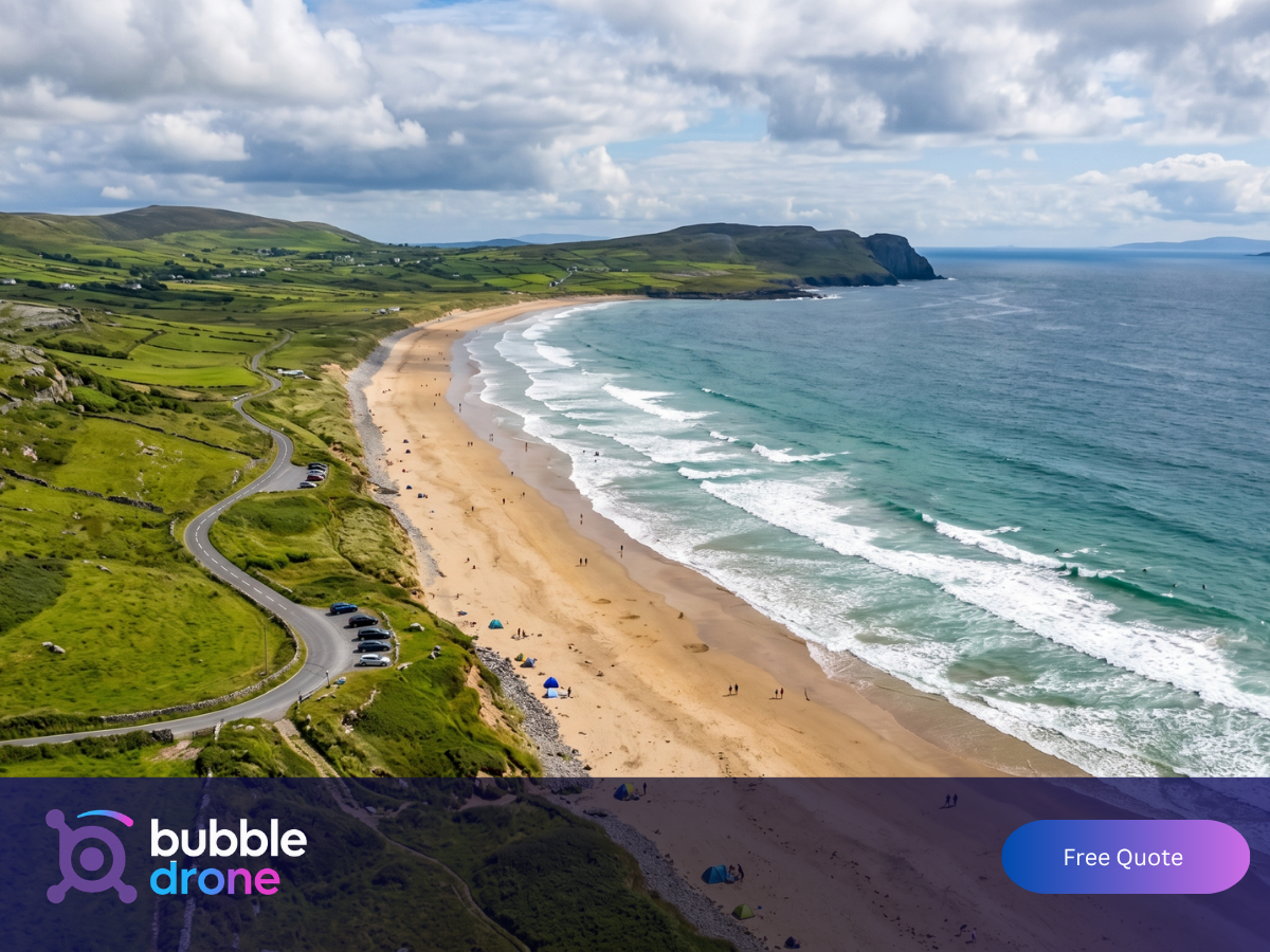
Drone construction photography gives you a dated, high-resolution aerial record of your build at every stage, from groundbreaking through to completion. Most construction disputes that go to formal claim could have been settled in ten minutes with a dated aerial image. The ones that drag on for months are usually the ones where nobody thought to document from above.
Industry data puts the share of construction projects that encounter contractual disputes at up to 30%. A single overhead shot taken on the right date often resolves those queries faster than any written report or site walk.
What Does Construction Drone Photography Actually Cover?
The term covers more than most people expect. At its simplest, it means high-resolution stills and 4K video captured at agreed intervals throughout a build. At its most comprehensive, it includes video for stakeholder presentations, time-lapse footage of the entire construction progression, aerial mapping for planning applications, site inspection from altitude, and completion shots for marketing and portfolio use.
Which of these you need depends on the size of the project and who needs to see the output. A residential developer completing ten units in Kildare has different requirements from a commercial contractor building a logistics facility in Dublin. A single drone shoot can serve multiple purposes at once, producing stills, footage, and aerial photos that each do different work.
The core deliverables from a typical engagement are:
| Deliverable | Format | Primary use |
| Scheduled aerial photography | High-resolution stills | Progress documentation, dispute resolution |
| Aerial video | 4K footage | Investor and planning body presentations |
| Date-stamped imagery | Stills with metadata | Contractual records, condition discharge evidence |
| Time-lapse compilation | Edited video | Marketing, award submissions, company showreel |
| Completion shots | Stills and video | Brochure, website, social media |
The cost of a single documentation shoot is typically less than one hour of a solicitor’s time in a disputed claim. For projects running over several months, a regular programme costs a fraction of what one unresolved progress query can generate in management time, legal fees, or delayed drawdowns.
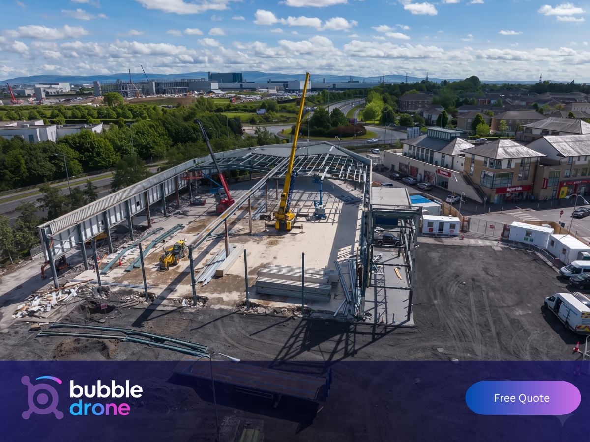
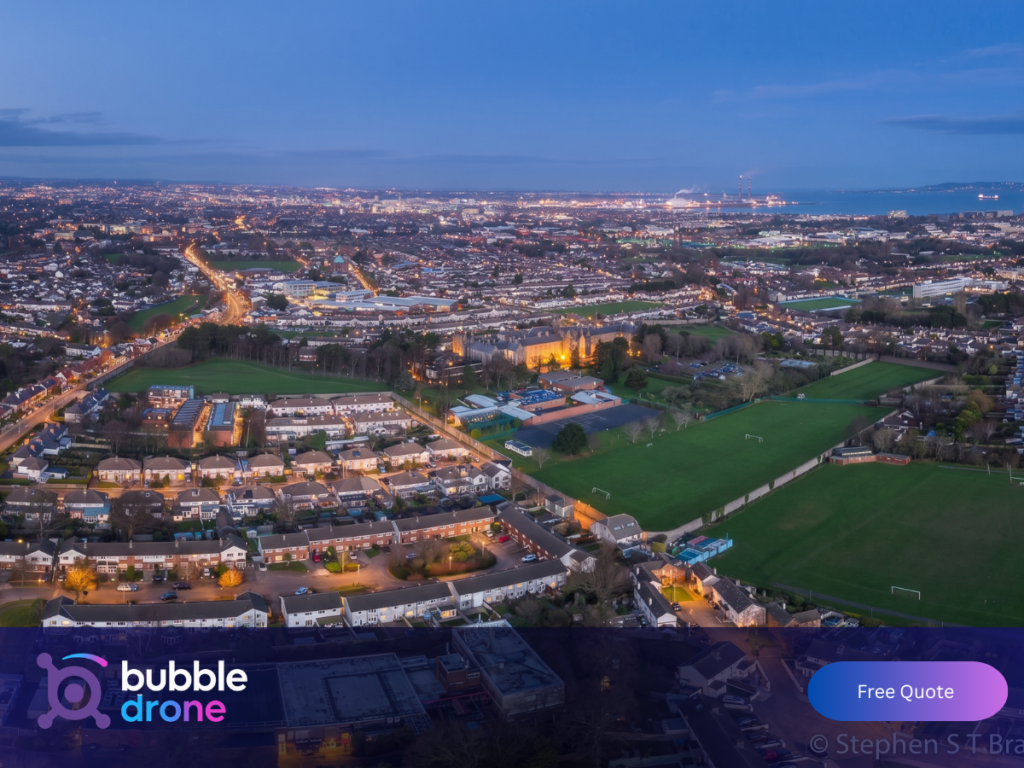
What Does Aerial Photography Capture That Ground-Level Shots Miss?
The problem with ground-level site photography is that it shows you parts. A drone shows you the whole.
A project manager walking the site captures walls, floors, and details. Useful, but limited. A drone flight captures the full footprint: drainage runs, roof structure, surrounding context, access roads, and the relationship between all parts of the build at once. That single overhead shot can confirm compliance with a planning condition and illustrate verified progress to a financial institution.
Construction companies who rely on aerial documentation report that it reduces the back-and-forth on progress queries significantly. Instead of explaining where a project stands, you show it. One high-resolution image taken on a fixed date is a cleaner record than any written report.
A medium-sized developer in Kildare found this out directly. They had scheduled weekly drone captures throughout a 12-month build. When a neighbour contested boundary works near the end of the project, the developer produced a dated aerial showing the completed drainage and boundary treatment. The issue was resolved within a week rather than escalating to legal costs.
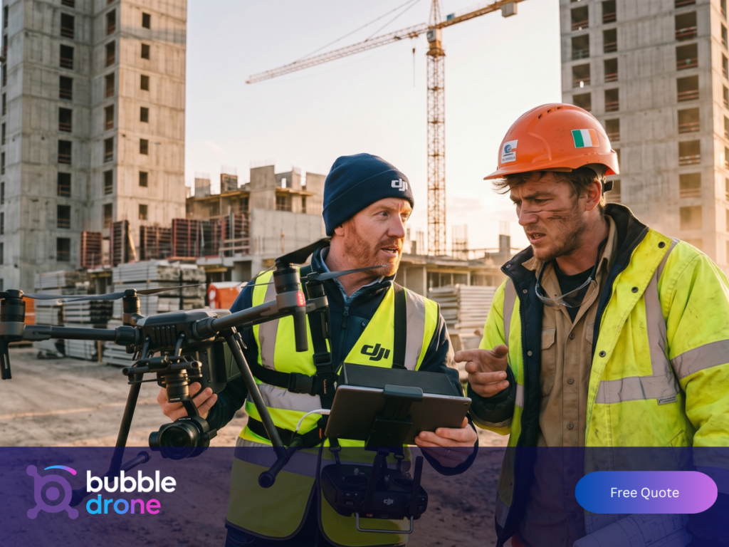
Why Construction Site Drone Work Requires More Than a Standard Operator
Not every drone operator is set up to work on a live construction site. The gap between one who is and one who is not becomes obvious the moment something goes wrong on site, and the consequences land on your health and safety file, not theirs.
Moving plant, crane operations, shifting terrain, safety exclusion zones, and personnel on the ground all require a pre-flight briefing with your site manager before every visit. A qualified operator plans the flight around active work zones, maintains safe distances from all personnel, and coordinates with your team so the shoot happens without disrupting your programme.
In Ireland, any operator flying commercially must hold a valid IAA licence and EASA certification. Public liability insurance is a separate requirement. Worth confirming before you book. At Bubble Drone Services, our pilots are fully insured with CoverDrone and hold all required authorisations. An uninsured or unlicensed operator on your site is a liability exposure that sits on your health and safety file, not theirs.
If your project is near Dublin Airport, Cork Airport, or any other controlled airspace zone, additional aviation permissions are required. The same applies to sites near national monuments or restricted zones. A qualified operator handles this coordination as a standard part of the pre-shoot process. Check with your operator before assuming access.
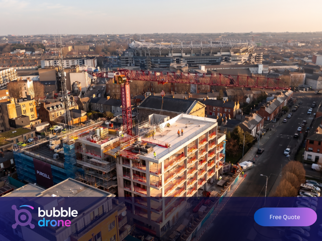
How Drone Footage Strengthens Stakeholder and Investor Reporting
Construction projects have more audiences than the site team. Investors, financial institutions, local authority planning departments, and future purchasers all need visual evidence of progress at various points in the build lifecycle.
Aerial video captured at consistent intervals does two things at once. It gives you the documentary record for internal use and external scrutiny. And it gives you a high-quality visual asset you can use in every investor presentation and planning submission from that point forward.
A developer who can open a quarterly stakeholder meeting with a two-minute progression video is showing credibility in a way that a PDF report cannot. Financial institutions drawdown funding against verified progress. A clear, date-stamped record from a regular drone shoot is exactly the kind of documentation that speeds that process along.
Firms using regular aerial documentation commonly report reductions in progress reporting administration of 20 to 40 percent, alongside faster funder drawdowns. Drone photography earns back its cost well before the project completes.
Why Every Construction Project Should End with a Time-Lapse Video
Every construction project that completes leaves behind a story: how a cleared site became a finished building over months or years. Most firms do not capture it. The ones who do have a marketing asset most of their competitors do not.
A construction time-lapse compressed from months of weekly aerial visits into two or three minutes of footage shows the full arc of a build in a way no photograph can. It works for award submissions, LinkedIn content, company showreel, tender documents, and client presentations. Time-lapse videos typically generate two to four times more engagement on professional channels than static photography posts, and they hold attention in a way a single still never will.
It requires no additional site time to produce. If you are already scheduling regular aerial photography for progress documentation, time-lapse is simply the edited version of what you have already captured. The footage exists. The only additional cost is the edit.
What Planning Authorities in Ireland Expect from Your Aerial Records
If your project requires planning permission or involves phased condition discharges, dated aerial photography is no longer optional. Planners expect it. A high-resolution orthomosaic or survey image gives them the spatial context to assess compliance accurately, without a site visit.
For larger developments with phased conditions, aerial mapping at each phase provides the timestamped visual evidence that demonstrates compliance without a site visit. This is particularly relevant for residential schemes and mixed-use developments where plot coverage, setback distances, and landscaping conditions need to be verified.
How a Construction Drone Shoot Works: Briefing, Flight and Delivery
The process for a straightforward engagement breaks down into three stages.
First, a pre-shoot briefing between the operator and your site manager. This covers active work zones, crane schedules, any restricted areas, and the specific angles and coverage areas required. This briefing is not optional. It is what makes the shoot safe, efficient, and useful.
The shoot itself typically takes between one and three hours depending on site size and the volume of footage required. The operator captures both stills and video to give maximum flexibility in post-production. Our standard turnaround for edited commercial footage is three to five days from shoot date.
Delivery is straightforward. Final files arrive via a secure download link, formatted for immediate use in presentations, planning submissions, or social media. If you need specific formats for your project documentation workflow, confirm these before the shoot.
Choosing the Right Drone Operator for Your Construction Project
Construction sites are specialist environments. You need a pilot with active site experience, not someone who has mainly shot weddings and properties.
Ask the operator the following before committing:
Is the pilot licensed and certified? Do they carry public liability insurance? Most professional operators working on Irish construction sites carry a minimum of €1 million to €5 million in cover. Confirm the level before you commit. Have they worked on active construction sites before, and will they coordinate with your site manager ahead of each visit? What happens if weather or site activity forces a reschedule?
A professional drone operator answers all of these without hesitation. An operator who is vague on any of them is a risk to your health and safety file, your insurance position, and potentially your planning compliance.
In our experience, the operators who cause problems on construction sites are rarely the ones who lied about their credentials. They are the ones who never expected to be asked.
At Bubble Drone Services, we work with project managers, developers, and construction companies across Ireland. Our pilots are licensed, insured, and experienced on active sites. See our full range of drone services, from progress documentation through to time-lapse production, or get in touch to discuss your project.
Get a Quote for Construction Drone Photography in Ireland
If you are planning a new build or want to start documenting a project already under way, Bubble Drone Services covers construction sites across Dublin, Cork, Galway, Limerick, and nationwide.
Our pilots are licensed, fully insured, and have worked on active sites across Ireland. We handle everything from the pre-shoot briefing with your site manager through to final file delivery.
Tell us about your project and we will put together the right package. One shoot, a full programme from groundbreaking to completion, or time-lapse production for a build that is finishing up. The sooner documentation starts, the more of the build it covers.